6.1 Expeditions and Experiences
Efforts will be made to carefully design and develop both major and minor destinations throughout East Iceland. The infrastructure serving tourism will be strengthened, and a network of routes for diverse modes of travel will be developed.

V. Tourism Resource Strategy
V.1 The diverse landscape of East Iceland will be utilized to enhance the quality of life and tourism, while protecting its unique characteristics.
Efforts will be made to distribute the development of entertainment and tourism as widely as possible across the region to prevent overloading specific locations and ensure that the entire area benefits from increased services.
V.2 The transportation, utility, and telecommunications systems will be optimized and strengthened in relation to both tourism and residence.
Efforts will be made to ensure that tourism development utilizes and strengthens the transportation network and other infrastructure throughout the region to benefit the entire area, while preventing overloading specific hubs or locations.
V.3 The region’s products, services, and cultural life will benefit and strengthen both residents and tourists.
Tourism providers will be encouraged to utilize the existing services and products in the area while fostering the creation of new products.
Explanation of the Tourism Resource Strategy
The landscape and unique locations of East Iceland can be viewed as resources for residents and visitors to enjoy. This resource is vital for the residents’ quality of life and serves as the foundation of tourism. It is crucial to protect this resource while identifying opportunities for further development of living quality and economic activity.
Infrastructure in East Iceland, such as airports, harbours, and roads, offers opportunities for further utilization and development in entertainment and tourism. However, maintenance and strengthening of these infrastructures must keep pace with the increase in tourist numbers and the associated strain on specific locations.
Visitors experience the region through East Icelandic products, services, and cultural life. The more positive the experience, the more attractive East Iceland becomes to both residents and visitors. Enhancing the quality of goods and services, such as food products, dining, and accommodation, benefits both groups.

X. Travel Route Strategy
X.1 A network of travel routes for diverse modes of transport, with narratives and destinations, will be developed throughout the region.
The development of longer and shorter driving routes, walking trails, riding paths, and cycling routes will continue, utilizing old national routes and offering opportunities to enjoy the diversity of East Iceland’s landscapes, nature, and culture, all over the region.
Walking, riding, and cycling routes will be mapped and categorized by length and difficulty level.
Routes connecting municipalities will be incorporated into the master plan.
Routes suitable for travellers with varying mobility, development, and abilities will be developed.
Designing bike and walking paths along the busiest highways will be done in consultation with the Road Administration, ensuring that these paths meet the institution’s safety requirements, making them eligible for funding under the transportation plan.
Coastal routes will be developed, including defining points where docking is allowed, such as for boats transferring passengers from cruise ships to land.
Opportunities for traveling on lakes and rivers will be developed.
Travel routes will be featured on East Iceland’s tourism website, providing information about the managing entities (where applicable), length, difficulty level, and points of interest, including accommodation and service stations, horse resting areas, and landing points along the coast, where applicable.
Promotional material about the routes will be created and marketed effectively to both residents and visitors.
Product development related to travel routes, such as food products, crafts, dining services, accommodation, and entertainment options, will be pursued.
X.2 The accessibility and safety of travel routes will be improved, and their management clarified.
Parking facilities will be provided on driving routes and at the start and end of certain walking and cycling routes, making it easy to combine travel modes.
Efforts will be made to minimize conflicts between travel modes on popular routes through appropriate signage and regulations on where different travel modes are permitted and where they are not.
Certain winter travel routes will be defined, ensuring snow clearing and other winter services. This applies to walking and cycling paths in urban areas and their surroundings, as well as specific roads.
The load on individual routes will be monitored, and appropriate measures will be taken when deemed necessary.
Managers for the travel routes will be identified where applicable.
Emphasis will be placed on ensuring that guides in organized group tours have good local knowledge.

Explanation of the Travel Route Strategy
Defining specific long travel routes is a well-known method of regional development. The purpose is to coordinate the development of tourism in a particular area to strengthen its image and increase its attractiveness, which can, in turn, attract more visitors, new businesses, and even new residents. The travel routes can be driving, walking, riding, or cycling routes, and even coastal and water routes. There are many well-known international examples of developing and marketing such travel routes, such as the driving route along the west coast of Ireland and the national trail systems of England and Scotland.3
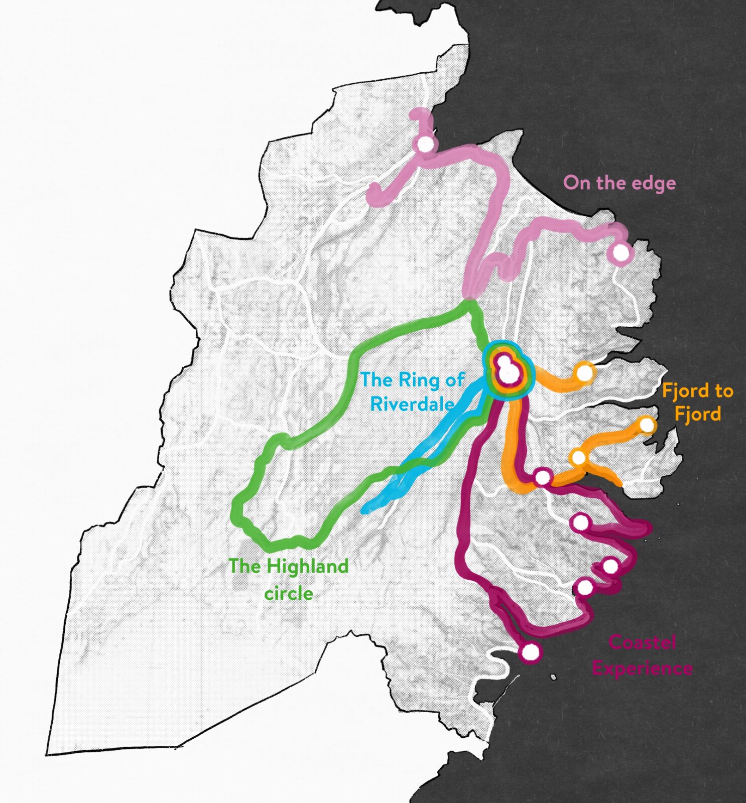
In Iceland, several driving routes have a shorter and longer history as marketed travel routes, such as the Golden Circle, the Diamond Circle, the North Coast Route, and the Westfjords Route. Others are in development, such as in Snæfellsnes.4 In East Iceland, corresponding development has been ongoing, and several travel routes for driving tourists have been introduced. These routes are distributed throughout the region: East Coast, Touring the Fjords, Across Wilderness and Valleys, At the Edge of the Sea, and the Fljótsdalur Ring.5
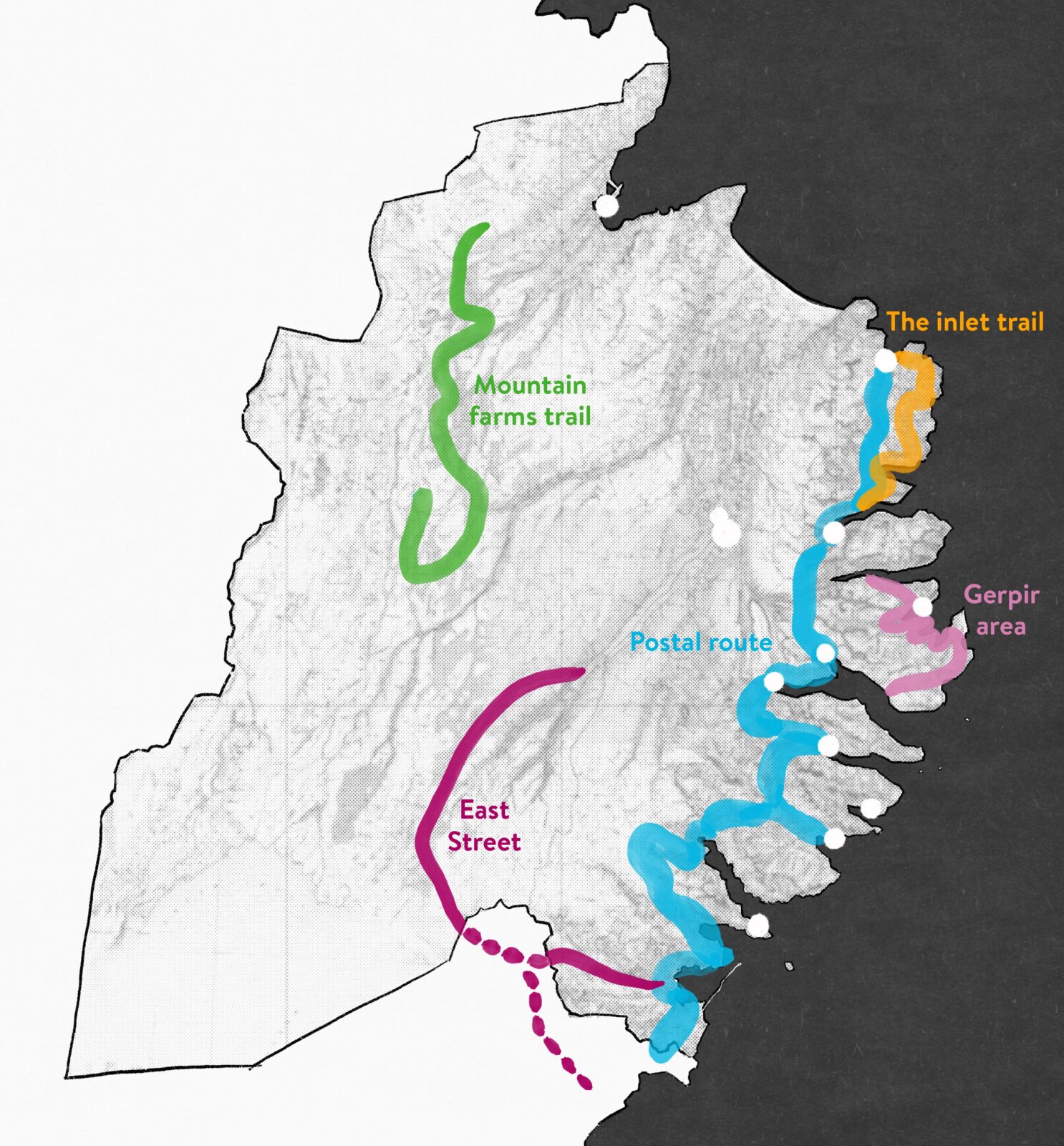
Descriptions of numerous walking trails in East Iceland have been provided on the East Iceland tourism website.6 Several longer routes are well known, such as Víknaslóðir, the Gerpir area, the mountain farms on Jökuldalsheiði, and the route between Fljótsdalur and Stafafell in Lón, which has been called Austurstræti.7 There are opportunities for further tourism related to these routes and event hosting, such as the Dyrfjöll Run in Borgarfjörður Eystri.
East Iceland offers interesting options for mountain biking tours and those who want to travel by bicycle. As elsewhere in the country, cycling is becoming increasingly popular in the region, and the opportunities are many. An initial development of such tourism can be found, for example, in the creation of bike routes in Rani Forest in Fljótsdalur and in Borgarfjörður Eystri, where old road paths are utilized.

Y. Destination Strategy
Y.1 A classification system for destinations will be developed as a planning tool.
Destinations on major travel routes will be categorized by type, accessibility, current or potential role in the travel route system, load/carrying capacity, and management. The need for infrastructure at these destinations will be assessed, such as whether specific facilities are needed (viewing platforms, toilets, path construction) or whether signage or other markings are required. An implementation plan will be based on this assessment.
The aforementioned classification and assessment will also be used to identify several key destinations throughout the region where infrastructure development will be aimed at being both an attraction for tourists and a protection measure for natural and/or cultural heritage sites.
Y.2 The design of destinations will be meticulous, and their development well-prepared.
All steps in the planning, design, and implementation process for destinations will be carefully executed.
A checklist for master and detailed planning of destinations will be created to ensure that regional planning and destination strategy priorities are met.
Municipalities will be encouraged to create framework plans for areas where the development of several destinations needs to be coordinated and/or where the interests of tourism need to be balanced with other land uses.
Y.3 Well-equipped campgrounds will be available throughout the region.
Well-equipped campgrounds will be ensured in urban areas and several selected rural locations.
Good facilities will include at least hygiene and cooking facilities, electricity, and in some cases, recreational facilities such as playgrounds.

Explanation of the Destination Strategy
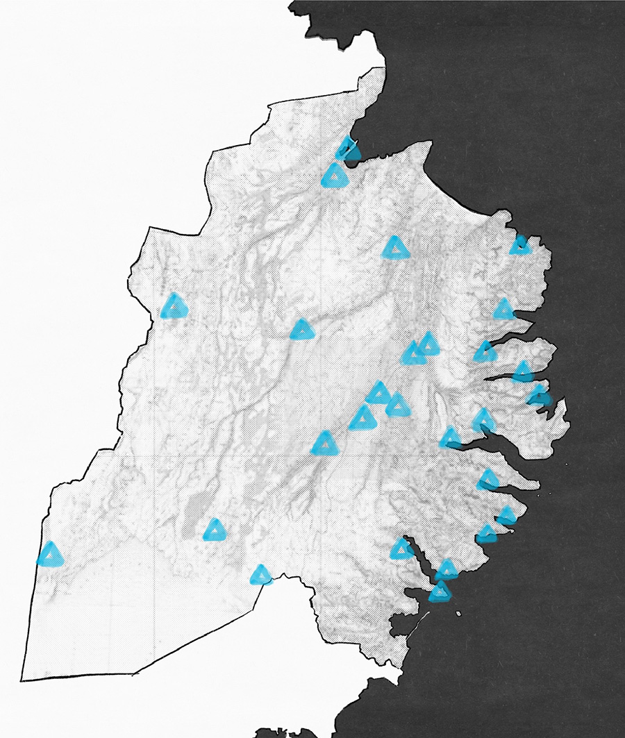
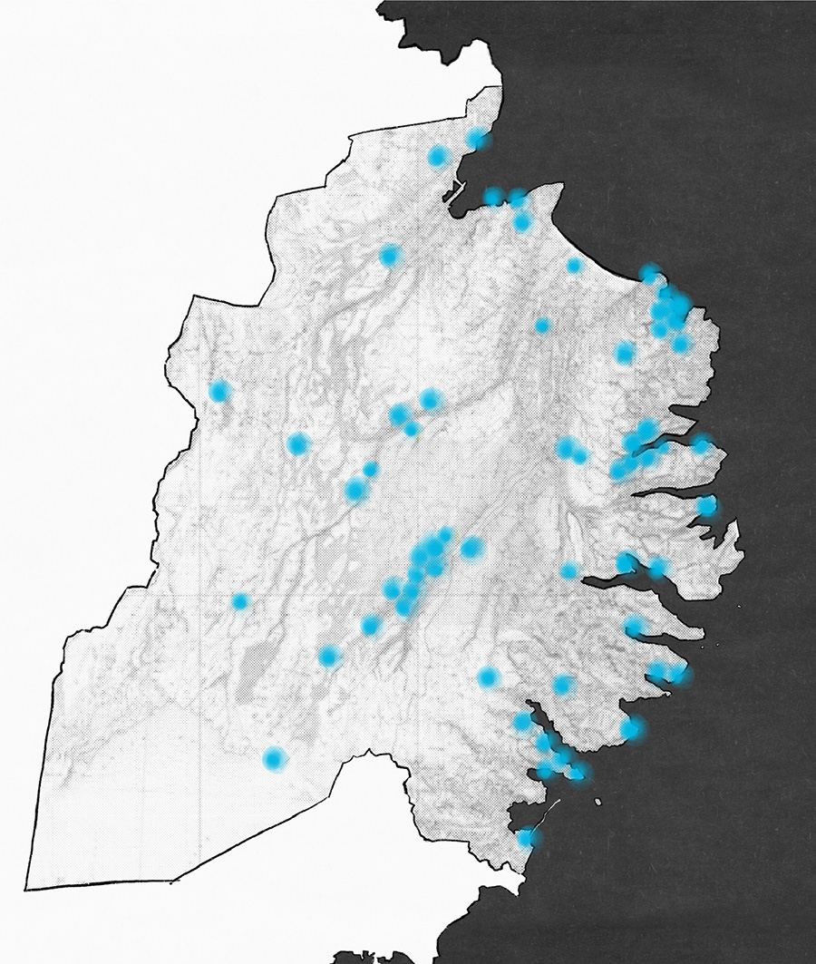
From 2014-2015, the Icelandic Tourism Board mapped potential tourist stopover points in Iceland in collaboration with locals to identify where tourism resources and opportunities lie for the future.10 These data were used in forming the East Iceland Destination Plan 2018-2021. Several destinations in the region are already on the implementation plan or in progress. Popular sites have been mapped in collaboration with municipalities, as well as potential other sites for future consideration.11
In further destination strategy development, it is important to define the different nature or types of tourist sites, such as their capacity and protection needs against high traffic. It is also useful to analyze which sites appeal to specific types of tourism. Master planning could play an important role here.12
In further destination planning on the highlands, it is essential to align with the national planning strategy and the management and protection plan of Vatnajökull National Park. The current national planning strategy mandates that the development of tourist facilities in the central highlands should be limited, focusing on development on the periphery and a few designated areas along the main roads. This approach is based on the former central highlands regional plan, which has lapsed but has been adopted by municipalities in East Iceland into their master plans.
